
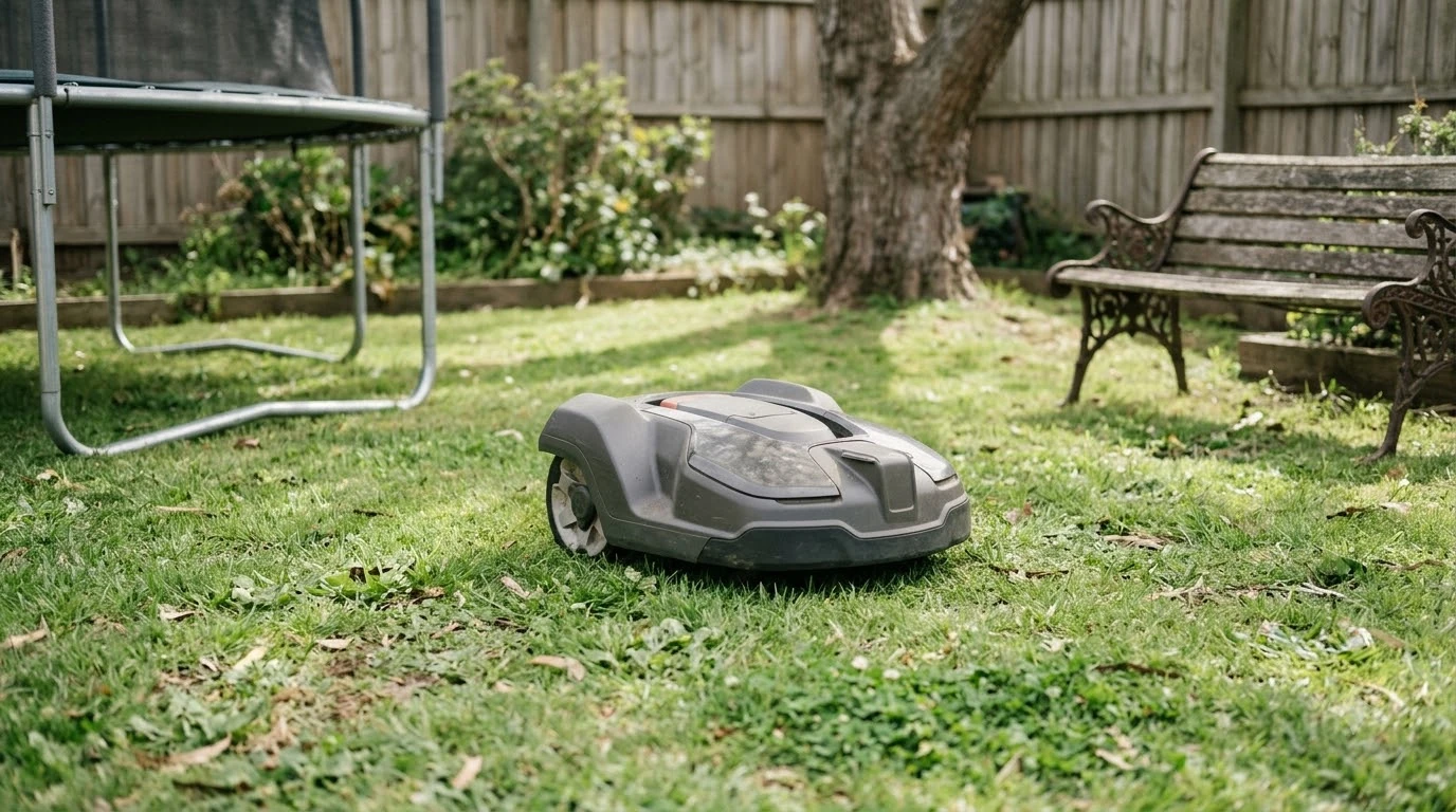

What is VSLAM navigation on a robot mower? It is a method that uses camera images to estimate where the mower is while it builds a map of the yard. VSLAM stands for visual simultaneous localization and mapping. Vendors usually pair it with wheel sensors and an inertial unit, and some models also use satellite positioning.
The short answer
- Camera-based positioning: the mower follows stable visual features from one camera frame to the next.
- Mapping at the same time: newly seen areas are added to a visual map, and recognizing an old feature helps correct drift.
- Usually paired: wheel encoders and an IMU can reduce uncertainty when the camera view is weak.
- Main weak points: darkness, a dirty lens, deep shade, and plain or featureless surfaces.
What is VSLAM navigation on a robot mower and how it tracks position
VSLAM navigation estimates movement by following visual features across consecutive camera frames. When those features shift in a consistent direction, the software can estimate how far the mower moved and which way it turned. Sunseeker’s glossary describes the process as a loop of capturing images, identifying stable features, estimating movement, updating position, and refining the map. Those steps are the vendor’s own explanation.
The mapping part runs at the same time as the positioning part. As the mower sees new ground, it adds that information to a visual model of the yard. When it later recognizes a feature it has seen before, it can correct the small errors that build up as it drives. That correction is what keeps the map from slowly drifting out of line with the lawn.
Why VSLAM is paired with wheel and inertial sensors
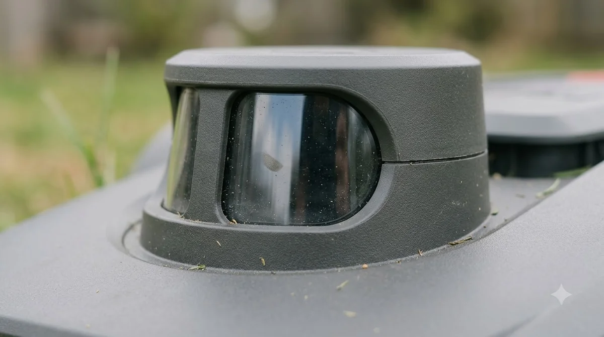
A camera alone is not enough for every moment of a mowing run. Sunseeker’s glossary names wheel encoders, which estimate distance from wheel rotation, and an inertial measurement unit, which measures tilt, rotation, and acceleration, as the usual companions. Sunseeker says these sensors can reduce uncertainty when the camera view is weak, such as when clippings cover the lens, but they do not replace VSLAM.
Obstacle awareness can come from separate hardware or from a camera, depending on the model, and it does a different job from VSLAM. Positioning answers the question “where am I on the map?” while obstacle sensors answer “is something in front of me?” In short, what is VSLAM navigation on a robot mower? A camera-based position estimate that gets help from other sensors. Our reading is that a spec sheet listing VSLAM tells you about positioning, and it does not tell you how the mower handles a child’s toy or a garden hose in its path.
How VSLAM differs from vision obstacle detection
VSLAM and vision obstacle detection both use cameras, which makes them easy to confuse. VSLAM tracks the mower’s own movement and location, while vision detection classifies what is in front of the mower. Husqvarna’s support page describes its AI vision as detecting objects in real time, and on some models detecting the physical lawn edge and verifying that the mower is on grass when satellite signal is lost. It lists daytime-only models and day-and-night models that have an infrared camera.
| Function | VSLAM positioning | Camera vision features (Husqvarna example) |
|---|---|---|
| Main question | Where is the mower on the map? | What is in front of the mower, and where is the lawn edge? |
| Output | Position estimate and visual map | Object detection, lawn-edge detection, grass verification |
| Typical companions | Wheel encoders, IMU, sometimes satellite positioning | Satellite navigation, which the camera backs up when the signal is weak or lost |
| Main limit named by vendors | Dirty lens, darkness, featureless surfaces | Husqvarna’s page names day-only and day-and-night models; it states no weather limits |
Our reading is that because the two systems fail in different ways, a mower can lose its position estimate while still detecting obstacles, or the reverse. The difference matters when you read a product page that lists several camera features under one heading.
Where VSLAM tends to struggle
VSLAM navigation needs visible detail to lock onto, which is why it is only one of several positioning methods, alongside others such as UWB navigation. Sunseeker states that a dirty or blocked camera lens can stop the system from tracking stable visual features. The same glossary says standard camera-based VSLAM cannot navigate effectively in complete darkness, and that deep shade and sudden lighting changes can lower confidence and reduce positioning accuracy.
- Dirty lens: grass clippings or mud on the lens remove the features the system needs.
- Darkness: without light, the camera has little to track, so night operation depends on other hardware, such as the infrared camera Husqvarna lists on its day-and-night models.
- Plain surfaces: long, featureless areas, plain walls, and glare on wet pavement can reduce confidence.
- Seasonal change: moving grass, shadows, rain residue, and changing colors alter the view the map was built from.
Sunseeker’s VSLAM vs LiDAR article lists dusk, low sun, water on the lens, and repetitive scenery as conditions that can weaken camera tracking. It also says rain, fog, dust, reflective surfaces, and a blocked sensor window can still affect LiDAR returns. That article gives no accuracy numbers and comes from a vendor, so it is a guide to the trade-offs rather than a measured comparison.
Our reading is that a camera-dependent system depends on the lens staying clear, so the cleaning instructions, a lens cleaning kit and any app alert about camera view deserve a closer look than the headline feature list.
Hybrid systems and the numbers vendors publish
Some brands pair VSLAM navigation with satellite positioning, so the camera can cover gaps in the satellite signal. A Navimow article on its EFLS 2.0 system carries a headline that promises centimeter-level precision. We could not read the article body, so treat that headline as an unverified vendor claim.
Lymow’s UK guide says its vision system takes over for up to 10 minutes when satellite signal weakens under dense tree cover, and it adds that extremely dense canopy may still cause issues. That is also a vendor statement, and the page does not include test data. Neither source gives a positioning error in centimeters that you can check for your own yard, so what is VSLAM navigation on a robot mower worth in practice? We cannot say from published figures. For how the main systems compare, see how RTK, LiDAR and vision compare, and for tree cover see a vision mower for a poor satellite signal.
What to check on a spec sheet
If you are asking what is VSLAM navigation on a robot mower before a purchase, read the claim as a list of conditions rather than a single promise. Our reading is that these are the points worth confirming before you buy:

- Which other sensors are listed with VSLAM, such as wheel encoders, an IMU, or satellite positioning.
- Whether the manufacturer says the system works at night or only in daylight.
- How the manual says to clean the camera, and how often it recommends doing so.
- What the mower does when the camera view is poor, such as stopping, slowing, or switching to another method.
- Whether the company publishes any accuracy number, and under what conditions it was measured.
Frequently asked questions
Is VSLAM the same as a camera that sees grass?
Not exactly. VSLAM uses camera images to estimate the mower’s position and build a map. Grass or obstacle recognition is a separate function, although both can use cameras on the same machine.
Does VSLAM work at night?
Sunseeker’s glossary states that standard camera-based VSLAM cannot navigate effectively in complete darkness. Check the manual for any infrared or night-capable hardware on the model you are considering.
Does a VSLAM mower still need a boundary wire?
The sources we read do not settle this for any specific model. Lymow describes its vision system as a fallback alongside satellite positioning, so check the setup instructions for the exact model to see what it requires.
Is VSLAM more accurate than RTK?
The sources we read do not give a comparison with measured numbers. Our reading is that RTK and VSLAM work from different signals and fail in different places, so the better choice depends on tree cover, shade, and how often the lens is cleaned.
Sources
- Sunseeker: what is vSLAM glossary (manufacturer): definition, feature tracking, paired wheel and IMU sensors, lens, darkness, and shade limits.
- Sunseeker: VSLAM vs LiDAR (manufacturer): conditions that weaken camera tracking, LiDAR limits and no accuracy numbers.
- Navimow: Visual SLAM in robotic lawn mowers, EFLS 2.0 (manufacturer): headline accuracy claim only; the article body could not be read.
- Lymow: RTK vs wire setup guide (manufacturer): vision fallback for up to 10 minutes under dense tree cover, vendor claim without test data.
- Husqvarna support: how Automower AI vision technology works (manufacturer): object and lawn-edge detection, grass verification and day-only versus day-and-night models, used for contrast with VSLAM.
 Up next8 min readLearnWhat Is UWB Navigation on a Robot Mower?Updated Nov 11, 2026
 9 min readLearnWhy Do Robot Mowers Mow Every Day?Updated Nov 11, 2026
 8 min readLearnWhat Is Virtual Boundary Mapping on a Robot Mower?Updated Nov 11, 2026
 8 min readLearnWhat Happens If a Robot Mower Runs Over a Hose?Updated Nov 11, 2026
 9 min readLearnCan You Control a Robot Mower From Your Phone?Updated Nov 11, 2026
 7 min readLearnHow to Set a Robot Mower Schedule (and Why It Might Not Run)Updated Nov 11, 2026